Like a photo on this page?

Share on Facebook!
Follow us on Facebook:
Share this on Google!
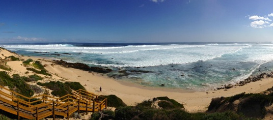
Heading to the South Coast? Visit Denmark, Western Australia along the Rainbow Coast
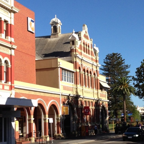
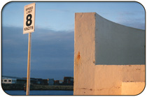
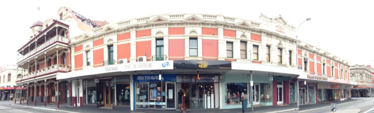
Welcome to Central Fremantle
Lonely Planet named Fremantle as one of the top 10 cities to visit and Australia's 'secret city'!
Locals and visitors alike flock to Fremantle to capture some of that distinctive Freo Feel, a unique atmosphere, where you will experience a joy of life and a love of this unique rich city.
This cosmopolitan city is filled with opportunities to eat, drink, rest, dance, shop, socialise, tour, adventure, plus much more...Central Fremantle is a lively hub, pleasant, clean and very easy to get around on foot, by car, by scooter or by free CAT bus.
The Fremantle Railway Station, centrally located in Phillimore Street, is the terminus of Transperth's Fremantle line. The station is Heritage Listed and was classified by the National Trust in 1974.
Fremantle (Central) incorporates the City Business District (CBD), the Cappuccino Strip, King's Square, main shopping precinct, Waterfront and Harbour, Notre Dame University, the Historic West End, Fishing Boat Harbour and the Fremantle Golf Club.
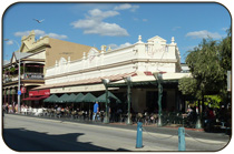
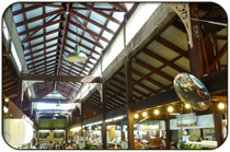
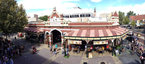
Many of the city's most beautifully preserved Colonial and Gold Rush heritage buildings and other attractions are located in central Fremantle, such as the Round House, Fremantle Prison, Kidogo Arthouse, the Town Hall, and the Fremantle Markets.
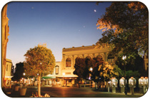
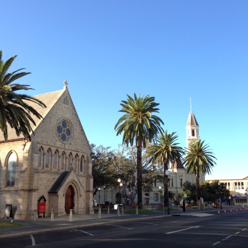
King's Square
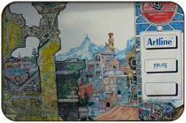
Downtown Fremantle winds its way through pedestrian shopping areas, to the historic West End and includes Kings Square and the Fremantle Town Hall, which serves as the civic and cultural centre for Fremantle. There is seating in the square, a small children's play area, toilets and shopping. Many cultural events including movies, music, markets and festivals take place in the square. It is a lively and dynamic area of central Fremantle.
John's Church of England has been standing in King's Square since 1843 and there are many public art works including:
Pietro Giacomo Porcelli (1993) – sculptor Greg James
Hughie Edwards Statue & Seat (2002) – artist Andrew Kay.
Chess Table and Chairs – artist Coral Lowry.
John Curtin (Artwork alongside the Town Hall building) – artists Charles Smith and Joan Walsh Smith.
Tom Edwards Memorial (1919) – sculptor Pietro Giacomo Porcelli.
(Wikipedia)
Food & Drink
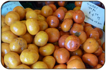
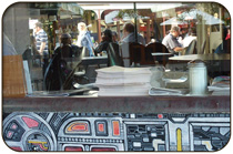
Central Fremantle offers a choice of food from all different cultures around the globe. Whatever your taste buds are in the mood for you can usually enjoy.
Food ranges from distinguished fine dining to super delicious fish and chips and lots in between. You can check out the range of Central Fremantle Restaurants
Fishing Boat Harbour
Fishing Boat Harbour offers a experience all of its own. This busy working port for fishermen is blended beautifully with all types of eateries and a well known Brewery.
Fishing Boat Harbour is a deep water harbour which has picturesque boardwalks, a lively atmosphere and plenty of things to see and places to explore for people of all ages!
There is also short stay accommodation, open ocean high-speed boat rides and luxury charter sailing tours available from the Fremantle Fishing Boat Harbour.
Fishing Boat Harbour Dining:
There is more to eat at Fishing Boat Harbour than Fish and Chips, but it's still our favourite! Fishing Boat Harbour boasts a great selection of food in Fremantle.Restaurants at Fishing Boat Harbour:
Bathers Beach House
Cicerellos Fish’n’Chips
Kailis Fish Market Cafe
Little Creatures Brewery
SweetLips Fish and Chips
Joe's Fish Shack
Char Char Bull
Helm

Fremantle Details:
Population: Estimated 31,046 (2015)
Postcode: 6160
Location: 19 km (12 mi) SW of Perth
LGA: City of Fremantle
State District: Fremantle
Federal Division: Fremantle
[wikipedia]
Fremantle Geography
Fremantle lies on a series of limestone hills known by the Nyungar people as Booyeembara; the sandplain to the east is Gardoo. The original vegetation of the area was mainly Xanthorrhoea and eucalyptus trees, being fired annually (in late spring or summer) by the traditional owners. [Wikipedia: Fremantle Geography]
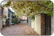
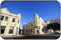
Fremantle's Historic West End
Fremantle has been recognised as the best preserved example of a 19th century port streetscape in the world.
The entire West End of Fremantle, including more than 250 buildings has been heritage-listed, the largest single place to be added to the State Register of Heritage Places.
Heritage Minister Albert Jacob said "Fremantle's West End is a rare example of a highly intact port city business district and is particularly notable for its impressive variety of gold boom era buildings. It includes former banks, pubs, hotels, warehouses, import-export businesses and shipping companies that speak to its maritime heritage."
Walking around Fremantle's West End is a never-ending visual delight with buildings adorned with fluttering flags, clear signposts on lampposts to get around, beautiful doors and balconies...the Fremantle West End is wonderful and it is officially heritage-listed in its entirety. Glimpse life in Colonial and Gold Rush eras, look up to see the marvellous architecture seemingly everywhere you look.
Enjoy the excellent historical tour through the Round House and listen to the firing of the 1 O'Clock cannon. This 12-sided former gaol is Western Australia’s oldest public building, located in the Arthur Head Precinct on a headland overlooking the river mouth, with uninterrupted views of Cockburn Sound.
Other buildings on Arthur Head included the courthouse, cottages and two lighthouses. Passing through Arthur Head is the Whalers Tunnel that enabled ease of access to Bathers Beach, Fremantle and the Long Jetty.
Maritime Shipwreck Galleries
The Western Australian Maritime Museum Shipwreck Galleries are found at Fishing Boat Harbour.
The Shipwreck Museum is the 'foremost maritime archaeology museum in the southern hemisphere' and was the original Maritime Museum.
We highly recommend a visit. Kids are engaged in the displays, there's lots to learn and lots to see. Excellent!
Central Fremantle
Fremantle's Historic West End
Incorporating the Fremantle Prison, Esplanade Park, Bathers Beach, Notre Dame University and the majority of Historic & Heritage buildings in Fremantle.
Fremantle West End Map and a movie of a Walking Tour of the West End.Fremantle Prison:
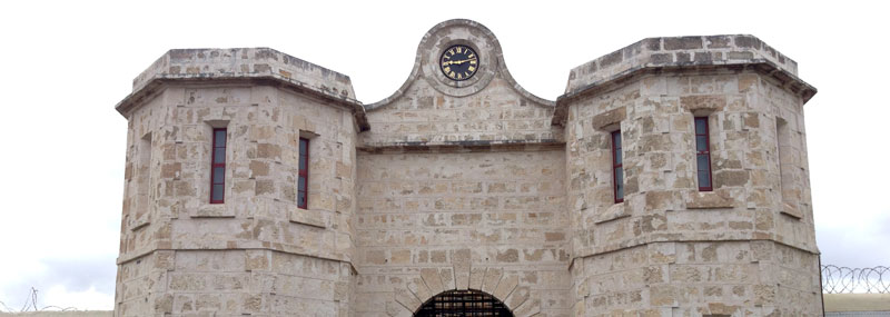
The Fremantle Prison Prison, sometimes referred to as Fremantle Gaol or Fremantle Jail, is a former Australian prison and WA's only World Heritage Listed Site.
The 60,000 m² (15 acres) site includes the prison, gatehouse, perimeter walls, cottages, tunnels, and prisoner art. The prison was built by convict labour in the 1850s, and transferred to the colonial government in 1886 for use as a gaol for locally-sentenced prisoners. It is now closed as a prison.
Fremantle Prison was constructed between 1851 and 1859, using convict labour. Now a major Tourist Attraction in Fremantle a visit to the Prison includes guided tours, a visitors' centre with searchable convict database, art gallery, café, gift shop and tourist accommodation.
Educational activities are regularly held for school children, as are exhibitions and re-enactments of historical events. Functions such as theme parties and dinners are held in the prison, with re-enactments serving as entertainment.
Tours of the prison show aspects of prison life and recount successful and attempted escapes. Sections of the tunnels are accessible, and night tours focus on the prison's reputation for being haunted.
Wikipedia
Fremantle Prison on Facebook.
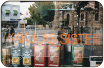
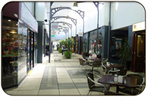
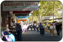
Fremantle shopping...
Fremantle is always a bustling port city whether you arrive at the weekend or during the week!
Both locals and visitors enjoy the seaside atmosphere of fun mixed with great choice and a backdrop of tranquility. You'll find the High Street brands plus a stunning array of gorgeous boutique and designer shops for fashion, accessories, lifestyle, gifts, homewares plus more, dotted around the streets of Fremantle and it's fringe.
A relaxed environment is created by the intertwining pedestrian-only walkways that connect throughout the central business district make it as pleasure to browse the diverse range of shops. There are plenty of places to eat and relax! Travel around easily using the FREE Cat Buses!
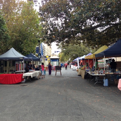
Esplanade Reserve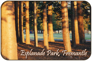
Esplanade Reserve offers so much to the visitor. Only a few minutes walk from central Fremantle.
The park is filled with opportunities for people of all ages. This beautiful city park is ideally located between Fishing Boat Harbour and Fremantle City Centre.
There are benches to rest and this is plenty of shade, from the magnificent 100 or so grand Norfolk Pine trees. This beautiful park offers a great place to spend a few hours, after swimming on Bathers Beach or shopping in town.
Within the reserve there is a small children’s climbing and play area which offers enough for kids of all ages. Enjoy a picnic on the grass or a light snack from the fabulous Carriage Cafe. The Carriage Cafe is a genuine 1912 West Rail Carriage that has been converted into a unique eatery. It has been on the Esplanade for over 30 years providing delicious food and great coffee as well as a friendly smile and great surroundings!
The Esplanade Youth Plaza attracts the vibrant youthful crowd and provides great opportunities for Skating in Fremantle. The EYP is a superb, purpose built award winning venue for skateboarding, BMX bikes, scooters and also has an outdoor parkour park, which is the first of its kind in Western Australia.
Located at the south eastern corner of Fremantle's Esplanade Reserve, it is a hub for young people and families.
The much acclaimed Fremantle Esplanade Youth Plaza also has a stage area for events and youth music gigs, a leafy promenade-styled footpath connecting the adjoining car park to the railway pedestrian crossing, a marine buoy incorporated into the bowl design (as a link to Fremantle’s maritime heritage), family ping pong area, 2 500 sqm of grass, 30–35 new trees and garden beds, plus seating and audience viewing areas. For all upcoming events and programs, please visit Freo Youth
The gorgeous and graceful Tourist Wheel stands magnificently at the edge of the Reserve, providing an inspiring backdrop. The 40 metre high ferris wheel has 24 gondolas and lifts you high above Freo for about 7 minutes. This is enough time to enjoy the ride and take in some of the best views of Fremantle.
Bathers Beach
It's easy to see why Bather's Beach is one of Fremantle’s favourite local beaches!Bathers Beach is a perfect beach to watch the sunset, as many of the locals do everyday! The generally calm waters of this 300m stretch of white sandy beach offer safe bathing for everyone, although it is unpatrolled and this beach is especially popular with families. The Indian Ocean provides a much welcomed breeze, especially during the hot summer months of November – February.
The beach is separated in two by a groyne that juts out into the sea and the Kidogo Art House which is a "bustling centre for art activity" in a beautiful location at the ocean's edge! A picnic lunch or dinner on the beach as the sun goes down off Bathers Beach is always an unforgettable experience.
Bather’s Beach is only a 10 minute walk from Fremantle’s shopping and entertainment precinct via Essex Street or Collie Street (both main streets). Cross over Marine Terrace and walk through the delightful Esplanade Reserve until you reach the Railway Tracks.
Fremantle Waterfront
The Fremantle Waterfront is a fully operating port with a lively bustling harbour atmosphere, a vibrant destination that is popular with both locals and visitors alike. It is sometimes referred to as the Maritime Museum Precinct.
We like to encourage visitors to visit Victoria Quay, the south-east side of the Docks known as the Fremantle Waterfront District or locally as "Victoria Quay."
The Waterfront district is accessible at the end of the Historic West End, south of the Train Station past the Port Authority Building. We recommend taking the FREE CAT Bus directly to the E Shed and Maritime Museum.
The Waterfront includes:
- Western Australian Maritime Museum
- The HMAS Ovens Oberon Class Submarine
- E-Shed Markets
- B-Shed, at the O'Connor Ferry Landing:
The Swan River and Rottnest Ferries land here.
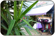
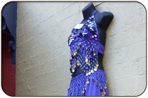 Colourful Fremantle Clothing
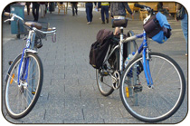 Fremantle is bike friendly.
Other amazing locations in the South-West of Western Australia!
More information on the south-west coast in our other Western Australian visitor guides:
Have you visited?
Fremantle WA
Fremantle, the Port City, is located south-west of Perth at the mouth of the Swan River. Fremantle's vibrant nightlife, music scene and cafe' culture make Fremantle a perfect getaway from the bustle of Perth. Beaches, history, shopping, dining out, and more. VISIT FREMANTLE
Ever visited
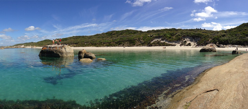
Margaret River, WA
The Margaret River Region is an area of magnificent beauty on the western coast of the south west of WA. From the expansive shores of Busselton on Geographe Bay, through Dunsborough & Margaret River to Augusta, the Margaret River Region is fantastic. VISIT MARGARET RIVER
Visit the
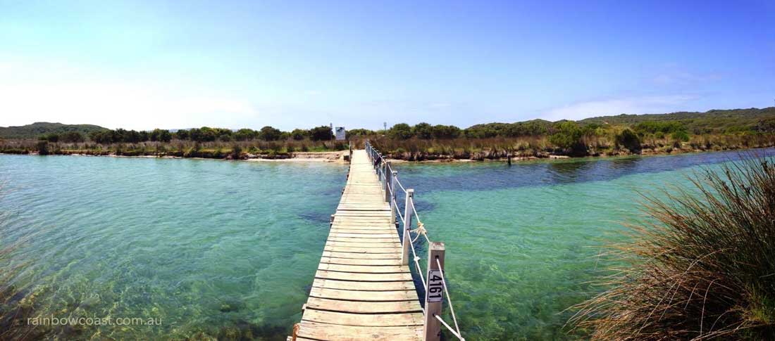
Rainbow Coast
The Rainbow Coast is a national biosphere area and deserves our care and respect, please try to reduce your environmental impact when visiting the coast. The Albany, Denmark and Walpole region of the South Coast is known as the Rainbow Coast
Have you visited?
Denmark WA
Denmark WA is one of the most beautiful places along the south coast as it has forests, beaches, rivers and waves. Everything you need for the perfect south coast holiday. Denmark Wineries are popular too! Info on Denmark Town including shopping, dining & history, VISIT DENMARK WA